Trung tâm phòng tránh và giảm nhẹ thiên tai

Disaster Management Policyand Technology Center

Giao diện dễ tiếp cận vietnam english
Log in

Management - Cooperation - Work together

  • Homepage
  • About
    • About DMC
    • Organization Structure
    • Function & Tasks
    • Development stratery
  • News
    • National and International News
    • DMPTC News
  • Information Center
    • Disaster infomation
    • Basic knowledge
    • Library
      • Legal documents
      • Reference documents
      • IEC documents
      • CBDRM documents
        • Legal documents
        • Reference documents
        • IEC documents
    • CBDRM (Program 1002)
      • Project Matrix
      • Technical Assistance Network
      • CBDRM documents
        • Legal documents
        • Reference documents
        • IEC documents
      • Monitoring and Evaluation (M&E)
      • CBDRA
        • Disaster risks maps
        • CBDRA Reports
        • Other maps
      • Disaster prevention plans
    • Disaster risk maps
    • Irrigation systems
    • Trainings and Workshops
    • Gallery
  • Partners
  • Projects
  • DMC-Mail
  1. News
  2. Details
  • Share this on Facebook
  • Share this on Twitter
  • Share this on GooglePlus

Can Tho city proposes to invest in building 11,218km of embankment against landslide

14:21:52, 03/09/2020 According to Can Tho City's Steering Committee for Natural Disaster Prevention and Search and Rescue, two main types of natural disasters are frequent in the city, causing damage to people's lives and property: rivers landslide and tornadoes.


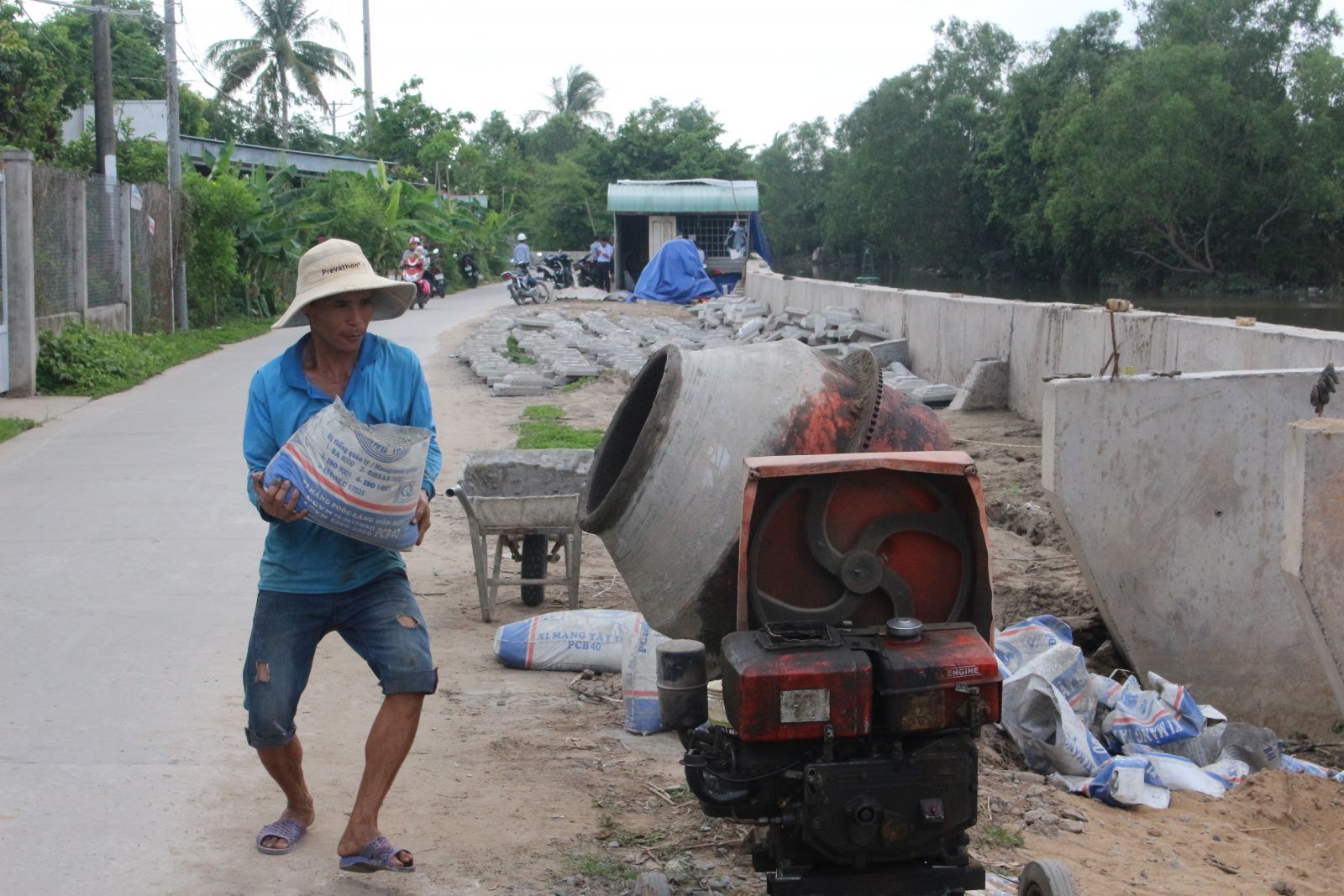
An embankment against Cai Son river erosion (Ninh Kieu district, Binh Thuy) is under construction to be completed by the end of 2020.

Only in the eight months of 2020, the city had 26 tornadoes, 30 landslides, collapsed and damaged 684 houses; killed 5 people (1 died from tornado, 4 died from lightning). Total property damage is over 21 billion. In the period 2010-2019, natural disasters in Can Tho City have killed 60 people (landslide killed 4 people, lightning killed 15 people, drowned 40 people, tornado killed 1 person); 2,293 houses collapsed, roof blown up, damaged; total length of roads and river banks being eroded was 7,356km; Total property damage was over 353 billion VND ... Currently there are 171 points in the city at risk of landslide, with a total length of over 179km, the total number of houses located in the area at risk of landslide that need to be relocated is 3,198. 

Over the past time, Can Tho city has reinforced over 3km of embankment to prevent landslides by traditional solutions (building coconut piles, eucalyptus piles, cajuput piles combined with gabions and geotextiles); construction of 10 embankments against landslide and put into use with a total length of 18,476km, implementation cost of 2,639 billion VND; 8 landslide protection embankments are in progress with a total length of 21.12km, implementation cost 2,345 billion; 6 landslide embankments are in the stage of making investment projects, with a total length of 5,735km, implementation cost of 681.61 billion VND. The above works contribute to stabilizing river banks, safety for people and urban development in the locality.

Currently, Can Tho city is proposing to the Central Government to include in the medium-term public investment plan for the period of 2021-2025 with 8 landslide-proof embankments, a total length of 11,218km, and a cost of 1,904 billion VND.

Read more

  • Yen Bai: Trees fell, houses had their roofs blown off, one person was injured due to a tornado
  • Dak Nong: Heavy rain accompanied by strong winds, greeting gates, trees in Gia Nghia city fell and fell
  • Malaysia records flood damage of over $210 million in 2024
  • Thanh Hoa: Escaped death when dozens of tons of rock fell on house
  • Ben Tre proactively responds to drought and salinity
  • The people of Lai Chau actively protect their livestock during the prolonged cold and severe cold weather.
  • Storm Tra Mi causes walls to collapse and roofs to be blown off in Quang Tri
  • Early resettlement for people living under landslides in Muong Nhe
  • Together, overcome difficulties, stabilize life
  • Nam Dinh evacuated nearly 500 households to safety due to the risk of rising flood waters.


  • Vietnam Natural Disaster Monitoring System (VNDMS)

  • Community-Based Disaster Risk Management Database (Project 553)

  • Socio-economic database

  • Riverbank landslides, coastal erosion database

  • Spatial for disaster management database

  • Library Disaster Management Policy and and Technology Center

  • Damage database

  • Satellite database

  • Science and Technology Database

  • Online Knowledge Dissemination Software for Disaster Prevention

  • Digital transformation portal in disaster management

  • Camera Management and Monitoring Software

Weather forecast

Copyright © 2015 - Disaster Management Policy and Technology Center

Address: No.54 - 102 Truong Chinh street, Dong Da, Ha Noi

Phone: +84-436291511 - Fax: +84-437336647

Email: trungtamcsktpctt@gmail.com - Website: www.dmptc.gov.vn

Online users: 279

Visistors: 19911474