Trung tâm phòng tránh và giảm nhẹ thiên tai

Disaster Management Policyand Technology Center

Giao diện dễ tiếp cận vietnam english
Log in

Management - Cooperation - Work together

  • Homepage
  • About
    • About DMC
    • Organization Structure
    • Function & Tasks
    • Development stratery
  • News
    • National and International News
    • DMPTC News
  • Information Center
    • Disaster infomation
    • Basic knowledge
    • Library
      • Legal documents
      • Reference documents
      • IEC documents
      • CBDRM documents
        • Legal documents
        • Reference documents
        • IEC documents
    • CBDRM (Program 1002)
      • Project Matrix
      • Technical Assistance Network
      • CBDRM documents
        • Legal documents
        • Reference documents
        • IEC documents
      • Monitoring and Evaluation (M&E)
      • CBDRA
        • Disaster risks maps
        • CBDRA Reports
        • Other maps
      • Disaster prevention plans
    • Disaster risk maps
    • Irrigation systems
    • Trainings and Workshops
    • Gallery
  • Partners
  • Projects
  • DMC-Mail
  1. News
  2. Details
  • Share this on Facebook
  • Share this on Twitter
  • Share this on GooglePlus

The circulation of storm No. 6 causes very heavy rain throughout the Central region to the North

9:59:33, 24/09/2021 According to the National Center for Hydro-Meteorological Forecasting, last night, typhon No. 6 weakened into a tropical depression and moved inland from Thua Thien Hue to Quang Nam.

This morning, September 24, storm No. 6 weakened into a low pressure area.

In the early hours of this morning, the central position of the low pressure area was at about 15.8 degrees North latitude; 107.1 degrees East longitude, on the Vietnam-Laos border area. The strongest wind in the center of the low pressure area dropped below level 6 (below 40km/h).

In this morning, the low pressure area moved mainly in the direction of the northwest, at a speed of 15-20km per hour. 


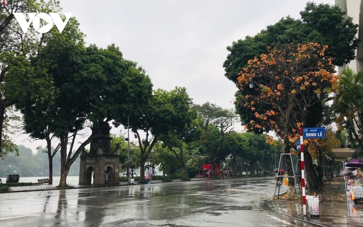
In the morning, Hanoi began to pour heavy and prolonged rain 

Due to the influence of circulation in the low pressure area combined with the East wind zone, in this morning in the offshore waters from Quang Tri to Quang Ngai there were gusts of 6-7; rough sea.

In the morning and today, in the waters of the Gulf of Tonkin, there are strong winds of level 5, in the South of the Gulf of Tonkin there are places of level 6 and level 7; sea ​​waves from 2.0-3.0m high; rough sea.

The situation of heavy rain and strong winds at sea due to circulation in the low pressure area combined with the high east wind zone also tends to expand to the north.

Since last night, due to the influence of storm No. 6, in the area from Quang Tri to Binh Dinh in the last 18 hours (7h/23/9-1h/24/9) there has been heavy rain with a total rainfall of 100 -200mm, some places over 250mm; Kon Tum, Gia Lai provinces are popular 80-150mm, some places are over 150mm.

It is forecasted that, due to the influence of tropical depression circulation (weakened from typhoon No. 6) after continuing to weaken into a low pressure area on the Vietnam-Laos border area, today, September 24 In the area from Ha Tinh to Thua Thien Hue, there is heavy to very heavy rain with a common rainfall of 80-150mm, in some places over 150mm.

In today and tomorrow, September 25, in the provinces of Thanh Hoa, Nghe An, the Delta and the Northern Midlands, there will be moderate rain, heavy rain with a common total rainfall of 50-150mm, some places over 200mm .

There is a high risk of flash floods and landslides in mountainous areas and local flooding in low-lying, low-lying and riverside areas.

Hanoi area today and tomorrow, with moderate rain, heavy rain and thunderstorms. During thunderstorms, there is a possibility of tornadoes, lightning, hail and strong winds.

In addition, due to the influence of the southwest monsoon with moderate intensity, from now until September 25, in the Central Highlands and the South, there will continue to be showers and thunderstorms, with heavy to very heavy rain in places with heavy rainfall. rainfall 30-60mm/24h, some places over 80mm/24h (rainstorms concentrate in the afternoon and evening
(Source: anninhthudo.vn)

Read more

  • Yen Bai: Trees fell, houses had their roofs blown off, one person was injured due to a tornado
  • Dak Nong: Heavy rain accompanied by strong winds, greeting gates, trees in Gia Nghia city fell and fell
  • Malaysia records flood damage of over $210 million in 2024
  • Thanh Hoa: Escaped death when dozens of tons of rock fell on house
  • Ben Tre proactively responds to drought and salinity
  • The people of Lai Chau actively protect their livestock during the prolonged cold and severe cold weather.
  • Storm Tra Mi causes walls to collapse and roofs to be blown off in Quang Tri
  • Early resettlement for people living under landslides in Muong Nhe
  • Together, overcome difficulties, stabilize life
  • Nam Dinh evacuated nearly 500 households to safety due to the risk of rising flood waters.


  • Vietnam Natural Disaster Monitoring System (VNDMS)

  • Community-Based Disaster Risk Management Database (Project 553)

  • Socio-economic database

  • Riverbank landslides, coastal erosion database

  • Spatial for disaster management database

  • Library Disaster Management Policy and and Technology Center

  • Damage database

  • Satellite database

  • Science and Technology Database

  • Online Knowledge Dissemination Software for Disaster Prevention

  • Digital transformation portal in disaster management

  • Camera Management and Monitoring Software

Weather forecast

Copyright © 2015 - Disaster Management Policy and Technology Center

Address: No.54 - 102 Truong Chinh street, Dong Da, Ha Noi

Phone: +84-436291511 - Fax: +84-437336647

Email: trungtamcsktpctt@gmail.com - Website: www.dmptc.gov.vn

Online users: 336

Visistors: 19911474